Mining & Exploration.
Precision geodetic control, large-scale topographical mapping, and volumetric analysis for resource extraction and exploration operations.
What We Do in Mining
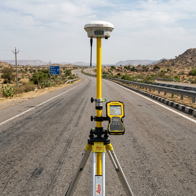
DGPS Geodetic Control Networks
Establishing high-precision Primary and Secondary Ground Control Point (PGCP/SGCP) networks across massive mineral exploration areas. We deploy survey-grade GNSS/DGPS receivers to provide the foundational geodetic framework required for accurate mineral resource mapping and statutory lease boundary demarcation.
Large-Scale Topographical Mapping
Executing rapid, high-resolution topographical surveys over hundreds or thousands of square kilometres using integrated drone photogrammetry and DGPS technology. We deliver centimetre-accurate Digital Elevation Models (DEM) and orthomosaics that serve as the baseline for mine planning, infrastructure routing, and environmental impact assessments.
Volumetric & Stockpile Analysis
Leveraging UAV data and terrestrial LiDAR to perform highly accurate volumetric calculations for mining stockpiles, overburden dumps, and excavation pits. Our 3D survey methods eliminate the interpolation errors of traditional total station surveys, providing mine operators with reliable quantity data for production auditing and contractor payment verification.
GIS Spatial Data Management
Structuring complex mining survey data into queryable Geographic Information System (GIS) databases. We help mining operators transition from fragmented CAD files to centralised spatial databases that track lease boundaries, drill hole locations, progressive excavation perimeters, and environmental monitoring points across the life of the mine.
Relevant Services
FAQ
Planning an exploration survey?
Send us your coordinates or lease map. We'll get back to you within 24 hours.