Ground Truth.
Precisely Established.
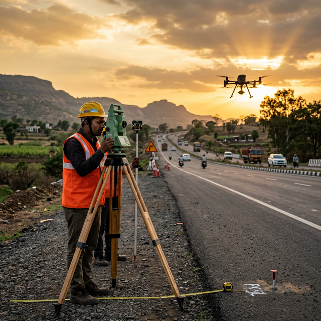
Centimetre-accurate DGPS, drone UAV, and USV bathymetric surveys for infrastructure corridors, water bodies, and AEC projects across India.
DGPS Accuracy
Dual-Frequency GNSS
Corridor / Day
UAV Photogrammetry
Certified Pilots
Drone Rules 2021
Core Capabilities
DGPS & Geodetic Control Networks
Establishing permanent, high-precision geodetic control networks using dual-frequency GNSS and Total Stations over hundreds of kilometres for highways, pipelines, and rail corridors.
UAV Topographical & Corridor Mapping
Rapid, area-wide terrain capture for infrastructure corridors and mining sites. Delivering centimetre-accurate orthomosaics, DTM/DSM, and contour maps governed by strict geodetic control.
USV Bathymetric Surveys
Unmanned Surface Vehicle (USV) deployments for water body mapping, reservoir surveys, and river cross-section data. Safe, efficient data collection for bridge design, dam hydrology, and JJM water schemes.
Precise Levelling & RTK Staking
High-order differential levelling for critical water and bridge infrastructure. RTK rover deployment for rapid topographic detail capture, construction staking, and as-built verification.
Project Deliverables
Technical FAQ
Ready to survey your project area?
Share your project brief. We respond within 24 hours.