Drone Surveys for PMGSY Rural Roads
How drone topography, DGPS control and GIS keep rural road DPRs tied to the ground: fewer deviations, faster sanctions, cleaner bills.
A PMGSY road lives or dies in its DPR. If alignments and quantities don't match the ground, the project bleeds money in deviations. Drone photogrammetry over a DGPS control network captures the corridor as it is, including habitations, drains and curves, and the design is drawn on that surface. Sanctions come faster and measurement books agree with the site.
Ask any rural roads engineer where a PMGSY project goes wrong and the answer is rarely the contractor. It is the DPR, drawn from a survey that missed the drain, the temple compound wall, or the low-lying stretch that floods every August. Drone surveys exist to kill that class of surprise before the estimate is prepared.
Why rural road DPRs drift from reality
A conventional corridor survey walks the centreline with a total station and picks up offsets at intervals. Between the pickups, the designer interpolates, and interpolation invents a road that does not exist. A culvert missed on the ground reappears during execution as a deviation. An unrecorded frontage becomes a compensation dispute. The flooded stretch shows up, reliably, in the first monsoon after opening.
PMGSY's scrutiny process punishes exactly this. Proposals bounce back for alignment justification, quantity mismatches and missing cross-drainage works. Every bounce costs a season.
What a drone corridor survey captures
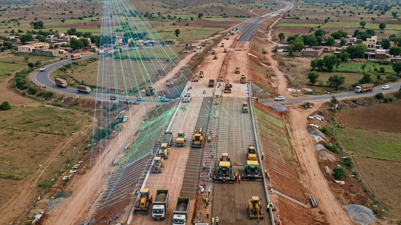
- Continuous orthomosaic of the corridor. Every metre is visible: habitations, field boundaries, drains, utilities and existing tracks.
- A DGPS-controlled surface model. Levels are tied to benchmarks and accurate enough for design cross-sections and quantity computation.
- Cross-drainage inventory. Every culvert, causeway and drain crossing is located, photographed and measured, so none is "discovered" at execution.
- Habitation and obstruction mapping. Frontages, religious structures, trees and encroachments are recorded with chainages, which defuses disputes early.
- Diversion and forest geometry. Surveyed areas and extents replace estimates in diversion and forest proposals.
Flown at the right height with proper ground control, a 10-kilometre corridor takes days rather than weeks, and the designer works from the site as it is, on screen, at any hour.
From surface to sanction
DPR products drop straight out of the surveyed model: alignment plans with curve details, longitudinal sections that show the flood-prone sags honestly, cross-sections at close intervals for earthwork quantities that survive scrutiny, and a GIS package the PIU can actually open. On recent rural road programmes, DPRs built on drone surfaces cleared technical scrutiny with a fraction of the queries that trace-based estimates attract. (Geopage project data.)
The value does not stop at sanction. The same control network serves construction setting-out, the corridor GIS becomes the maintenance register, and the next upgradation starts from an as-built surface instead of a fresh survey.
Related reading and services
- Drone survey of 4,000 villages: corridor-scale rural capture at programme scale.
- Geodetic control for survey-grade data: the DGPS backbone under every DPR.
- Network pavement condition surveys: maintaining the road after handover.
- Government sector programmes: JJM, PMGSY, PWD and NHAI delivery experience.
Start with a survey worth designing on
A rural road is only as good as its DPR, and a DPR is only as good as its survey. Fly the corridor, control it properly and design on reality, and most of the deviations, disputes and re-estimates stop happening.
Preparing PMGSY or rural road DPRs this season? Get a corridor survey quote from Geopage →
Frequently asked questions
What does a drone add over a conventional road survey?+
Completeness. A total-station pick-up records what the surveyor walks to; a drone records every house frontage, culvert, drain outfall and encroachment in the corridor. The designer sees the actual site, not a sampled version of it.
Is drone data acceptable for PMGSY DPR approval?+
Yes, when it is tied to DGPS ground control and delivered with standard DPR products: alignment plans, longitudinal sections, cross-sections, and quantity statements. The approving engineer checks the products and the control statistics, not the aircraft.
How do you handle habitations and traffic during the survey?+
Flights are planned above roof height with permissions and local notice, and DGPS control avoids long foot traverses through villages. Corridor photography documents every frontage, which later settles most compensation and alignment disputes before they start.
What about forest stretches and diversions?+
Drone corridors map the diversion geometry precisely: area, chainage-wise extent, canopy where relevant. Forest proposals then carry surveyed numbers instead of estimates, which can save months of back-and-forth.
Can the same data serve construction and maintenance?+
That is the point. The DPR surface becomes the construction reference, as-built checks reuse the same control, and the corridor GIS feeds directly into a [pavement maintenance register](/blog/pavement-condition-survey-pci/) after handover.
Related insights
More perspectives from our engineering team on related topics.
Designing a Multi-Village Water Scheme
From source yield to hydraulic modelling and the final DPR: how multi-village water supply schemes are engineered for the Jal Jeevan Mission.
Read ArticleChange Detection for Dams and Structures
Epoch-to-epoch laser scanning that separates real structural movement from survey noise, for dams, heritage, mines and high-rises.
Read ArticleWebGIS Asset Registers for Municipalities
A GIS nobody opens is a map, not a system. How PostGIS-backed WebGIS registers turn road, water and drain inventories into daily municipal tools.
Read Article